


Alright, Kansas City—get ready. This weekend’s weather isn’t going to be your typical spring affair. If you were hoping for clear skies and warm sunshine, you might want to rethink your weekend plans. A major storm system is moving in, bringing with it flooding, the potential for tornadoes, and temperatures that are way cooler than we’re used to this time of year.
Whether you’re hoping to head outside or are planning on spending time indoors, here’s what you need to know to stay safe and prepared. From severe weather warnings to chilly temperatures, let’s dive into what’s ahead.
Severe Weather on the Horizon: What’s Coming Our Way?
Kansas City is in for some tricky weather. The National Weather Service has issued a Moderate Risk for severe storms in our area, meaning it’s time to be alert. Here’s what’s happening:
Flood Warnings:
Rain is going to be a major concern. With this storm system pushing in, we can expect 1 to 2 inches of rain each day—and up to 12 inches of total rainfall by the time the storm is over. If you live near rivers or low-lying areas, you’re at a higher risk of flooding, so be cautious. Flash flood warnings have already been issued, and it’s important to pay attention to local alerts. Make sure your storm drains are clear, and if you haven’t already, check your emergency kit.
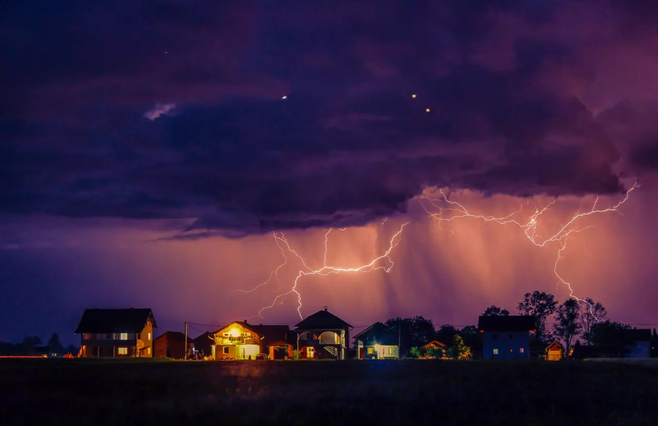
Tornado Threat:
It’s not just rain we need to worry about. This storm system also carries the potential for severe tornadoes. The risk is higher than usual for this time of year, and while Kansas City may avoid the worst of it, the storm can escalate quickly. If tornado warnings are issued, seek shelter immediately. The best place is a basement or an interior room on the lowest floor, away from windows.
Cooler Temperatures:
Now, here’s the kicker. As if the storm wasn’t enough, the temperatures are way colder than they should be for April. Today, we’re looking at highs struggling to reach the low 50s°F (around 10-12°C), and overnight lows will dip into the 30s°F (1-3°C). Definitely not the kind of spring warmth we were hoping for!
The Weekend Breakdown: What You Can Expect Each Day
So, what’s the weather actually going to feel like? Here’s a day-by-day breakdown so you know what to expect:
Friday, April 4: A Cold, Wet Start to the Weekend
-
High: 49°F (9°C)
-
Low: 41°F (5°C)
If you’re hoping for clear skies, think again. It’s going to be a mostly cloudy day with on-and-off light to moderate rain throughout the afternoon and evening. It’s not the heaviest rain yet, but it’s definitely not the day for outdoor activities—unless you’re into soggy walks. Stay dry and keep an umbrella close by!
Saturday, April 5: The Storm Grows Stronger
-
High: 48°F (9°C)
-
Low: 34°F (1°C)
Saturday is when things really kick up a notch. The rain will become heavier, and strong winds will start to pick up. Flooding is going to be a concern, especially in low-lying areas. Plus, the risk of tornadoes is higher, so make sure you have an emergency kit ready. Temps will remain chilly, so make sure you bundle up if you need to go out.
Sunday, April 6: More Clouds, More Cold
-
High: 53°F (12°C)
-
Low: 37°F (3°C)
While Sunday won’t bring as much rain as the previous days, it will still be a cloudy, cool day. We’re looking at partly sunny skies, but don’t expect it to feel like spring—temps will still hover in the 50s°F. If you were hoping to get outside and enjoy the sunshine, you might want to think again.
Looking Ahead: Warmer Days Just Around the Corner
While the weekend is going to be a tough one, the good news is that the weather is expected to improve as we head into next week.
-
Monday, April 7 will bring warmer temps, with highs climbing into the mid-50s°F, and there’s a chance we’ll see some sunshine.
-
By Tuesday, April 8, we could see even warmer weather, with temps reaching the low 60s°F (around 16°C), which means a much-needed break from the cold.
Staying Safe: Your Guide to Weathering the Storm
With all this extreme weather, it’s important to stay safe. Here are some tips to keep you and your loved ones protected:
-
Stay Informed: Always check for updates from reliable sources like the National Weather Service or local news stations. Weather conditions can change quickly, so be prepared to adjust your plans if necessary.
-
Flood Safety: Never drive through flooded roads—just Turn Around, Don’t Drown. Floodwaters can rise faster than you think, and it’s always better to be safe than sorry. If you live in a flood-prone area, consider moving important items to higher ground.
-
Tornado Safety: If a Tornado Warning is issued, take shelter immediately. The safest places are basements or interior rooms on the lowest floor of your home—stay away from windows, and always have an emergency kit ready to go.


