


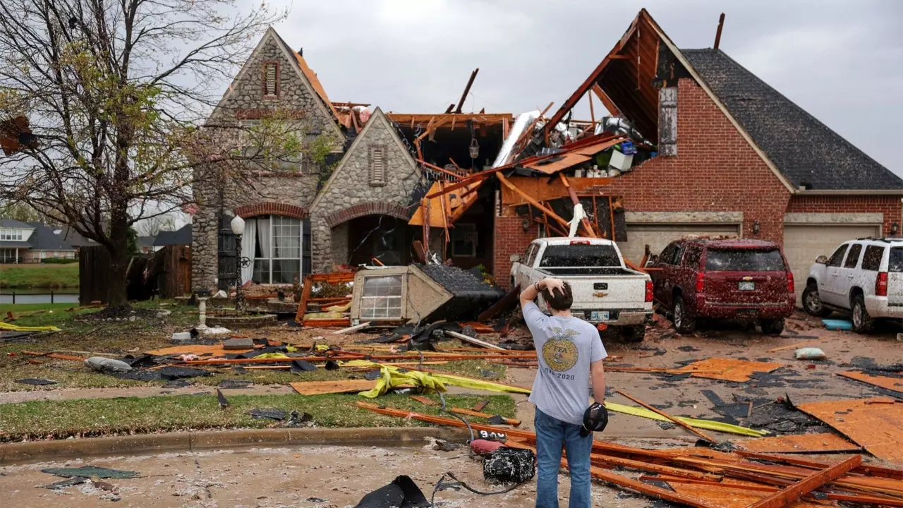
If you’ve stepped outside today, you’ve probably noticed the clouds rolling in. And unfortunately, that’s just the start. A big storm system is making its way through the area, bringing with it some serious weather. We’re talking heavy rain, thunderstorms, and possibly even tornadoes. While spring weather in Louisville can be unpredictable, this one looks like it could pack quite a punch.
As of Thursday morning, April 3, temperatures are hovering around 64°F (18°C) and the skies are pretty overcast. But don’t let the calm fool you. The heavy rain is on its way, and it’s going to get worse before it gets better. The National Weather Service has already issued warnings for flash flooding, severe thunderstorms, and even tornadoes, so it’s time to stay on high alert.
Here’s What’s Coming Up:
So, what can you expect over the next few days? Here’s the rundown:
-
Thursday, April 3: We’re in for a rough afternoon. Temperatures will stay around 66°F (19°C) with rain picking up through the day. Expect heavy downpours, strong winds, and possibly a tornado or two. Keep an eye out for severe thunderstorms, and if the sirens go off, take shelter immediately. The rain is likely to continue into the night with a low of 52°F (11°C).
-
Friday, April 4: It’s not over yet. More rain and thunderstorms are on the way, with a high of 66°F (19°C). As if that wasn’t enough, flooding is still a major concern. If you live in a flood-prone area, it’s best to avoid travel, especially if you can’t see how deep the water is. The low will stay warm at 64°F (18°C), but the rain won’t let up.
-
Saturday, April 5: This one’s a bit of a mixed bag. While the temperature will hit 73°F (23°C), we’ll also see intense thunderstorms, and yes, the risk of flooding continues. Be prepared for some severe weather late in the day, and if you’re near rivers or creeks, stay aware of how much water’s coming down. Flash floods could make driving dangerous, so be cautious.
-
Sunday, April 6: The storms will finally start to settle down, but it’s not going to be smooth sailing just yet. The high will only be around 50°F (10°C), and floodwaters will still pose a problem in some areas. Roads could still be blocked, so it’s a good idea to stay off them unless absolutely necessary.
Why the Flooding Is So Dangerous:
We’ve all seen it before—floodwaters rising quickly, covering streets, and making travel impossible. That’s what we’re dealing with here, but on a potentially larger scale. With up to 10 inches of rain expected over the next few days, it’s not just the rain that’s the problem; it’s how quickly it could accumulate. Louisville and surrounding areas near rivers and low-lying regions are especially at risk.
And on top of that, there’s the possibility of tornadoes. While not every storm will produce one, it only takes one to cause major damage. If you’re in an area under a tornado watch, don’t wait for the warning. Take cover early, and make sure you know where to go if things get bad. A basement or an interior room away from windows is your best bet.
What You Can Do to Stay Safe:
We all know weather can be unpredictable, but there are things you can do to make sure you’re prepared:
-
Stay updated: Make sure you’ve got reliable sources of weather information. Whether it’s local news, the National Weather Service, or weather apps, it’s important to stay informed. Conditions can change fast, and you don’t want to be caught off guard.
-
Have an emergency kit ready: If you live in a flood zone, it’s always a good idea to have an emergency kit on hand—just in case. Think about water, food, medications, and any important documents you might need if you have to leave your home.
-
Avoid driving through flooded areas: Even if you’re not sure how deep the water is, don’t risk it. Flash floods can happen fast, and roads that look passable one minute could be covered with water the next. If you see flooded roads, turn around and find an alternate route.
-
Take shelter when storms hit: If tornado warnings are issued, don’t hesitate—head to your safe spot right away. Get to the lowest part of your home, away from windows. If you don’t have a basement, an interior room or hallway is the next best option.
After the Storm: What’s Next?
Once the storm passes, the skies will clear, but that doesn’t mean the danger’s gone. Flooding will be an issue for a while, and even though the rain will stop, some streets could remain closed for a few days. Make sure you keep an eye on any roads you plan to travel on, as conditions could still be risky.
By Monday, April 7, things should calm down, with cooler temps and some sunshine breaking through. However, flooding could still be lingering in parts of Louisville, so be cautious when heading out.


