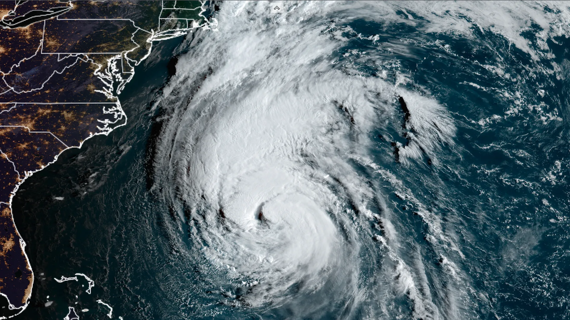
According to the National Hurricane Center, Hurricane Lee continued to travel northwest across the Atlantic Ocean Wednesday evening, with sustained winds reaching 105 mph as it approached the shores of New England and eastern Canada.

A screenshot of the Hurricane Lee tracker. (USA Today)
Tropical Storm Watch Announced for Hurricane Lee
As of Wednesday evening, hurricane and tropical storm watches have been issued for parts of New England. This signifies that hurricane or tropical storm Lee conditions are probable during the next 48 hours in the warning region. In addition, a storm surge warning has been issued for Cape Cod Bay and Nantucket, Massachusetts. Lee, now a Category 2 storm, is “likely to remain a large and dangerous hurricane into the weekend,” according to the Hurricane Center. Hurricane Lee is expected to become a major hurricane off the coast of New England on Friday night and Saturday.
As of Wednesday evening, the storm was roughly 965 miles south of Nantucket, Massachusetts. It was going at a speed of ten miles per hour. The center stated on Wednesday that “hurricane conditions, heavy rainfall, and coastal flooding are possible in portions of eastern Maine on Saturday.” Late Friday and Saturday, there is a risk of life-threatening storm surge flooding in parts of southern Massachusetts, including Cape Cod and Nantucket.”
Dangerous Surf and Strong Rip Currents Along New England Coast
Hurricane-force wind gusts could strike the New England coast, including Boston, late Friday or early Saturday, according to meteorologist Ryan Maue, writing on X Wednesday morning. Lee is a powerful storm. Lee is a big hurricane, with hurricane-force winds extending outward up to 115 miles and tropical-storm-force winds extending outward up to 265 miles from the center. “Because of Lee’s large size, hazards will extend well away from the center, and where the center reaches the coast will have little to no significance,” the center stated.
According to the hurricane center, “dangerous surf and life-threatening rip currents” will strike sections of the northern Leeward Islands, Virgin Islands, Puerto Rico, Hispaniola, Turks and Caicos Islands, Bahamas, Bermuda, and much of the US East Coast this week before it reaches New England. This prediction track depicts the most likely route of the storm’s core but does not depict the storm’s entire extent or its repercussions. The storm’s core may migrate outside the cone up to 33% of the time.
Spaghetti model pictures depict a variety of forecast tools and models, but not all of them are made equal. The hurricane center bases its projections on the top four or five best-performing models.
READ ALSO: NHC: Tropical Storm Lee Labels as ‘Extremely Dangerous’ Hurricane


