


Different Tropical Storms are constantly developing into a Tropical Depression. Tropical Depression Ten According to the National Hurricane Center, the storm will strengthen on Monday and Tuesday when it traverses the Gulf and heads toward Florida. The official trajectory predicts the storm will become a hurricane in the eastern Gulf of Mexico by Tuesday afternoon and make landfall on the western Florida Peninsula by Wednesday. The predicted cone runs from Tampa Bay to Panama City, and the NHC warns “that there is significant uncertainty in 3-4 day intensity predictions and the public are urged to monitor changes to future forecasts.”

The European model simulation on the odds of a tropical storm developing. (WeatherBell) (Source: The Washington Post)
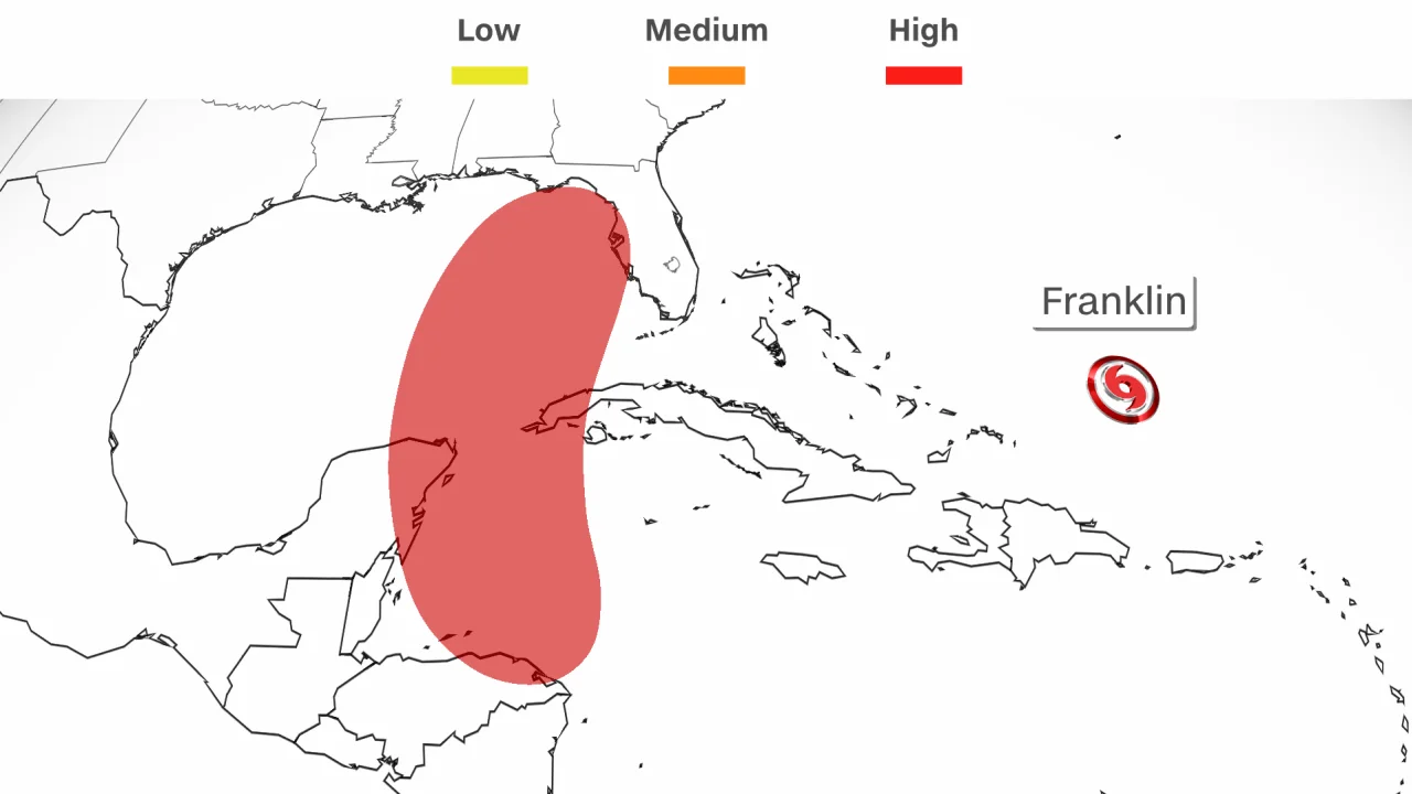
Developing Tropical Storm Franklin
Tropical Storm Franklin becomes a hurricane as it approaches Bermuda. The Middle Atlantic was home to Tropical Storms. The National Storm Center updated Saturday morning that Tropical Storm Franklin had intensified into a Category 1 storm with 75-mph winds. NOAA and Air Force Hurricane Hunters confirmed this by airplane reconnaissance. Hurricane Franklin is 620 miles south of Bermuda and traveling north-northwest at 7 mph. In its assessment, the center predicted Tropical Storm Franklin’s strengthening and potential as a major hurricane early next week. A major hurricane has Category 3 or higher winds of 111 mph.
The Hurricane Center said that the swells generated by Franklin are expected to begin affecting Bermuda by Sunday night. Those swells are also likely to cause life-threatening surf and rip current conditions late this weekend into early next week along portions of the East Coast of the United States. Franklin’s track during the weekend will determine its closest pass to Bermuda on Monday and Monday night.
Tropical Storm Franklin will see winds and showers outside its core. Bermuda may experience tropical storm-force wind gusts early next week as Franklin approaches. Bermuda may get some showers and thunderstorms when Franklin passes.
READ ALSO: Tropical Storm Harold was Seen This Week Looms to Bring Tornadoes in Texas and Mexico
Transformation of a Tropical Depression into a Tropical Storm
Idalia is the next Atlantic storm name. The Yucatan Peninsula, Cuba, and the northern Gulf and Florida coast should watch the prediction in the coming days. The direction and strength of upper-level steering winds will determine where and how fast this system moves. Saturday, Florida Governor Ron DeSantis declared a state of emergency for 33 counties ahead of possible bad weather. The executive order’s news release states, “The Governor and the Florida Division of Emergency Management are taking timely precautions to ensure Florida’s communities, infrastructure, and resources are prepared, including those communities that are still recovering from Hurricane Ian.”
The depression will become a tropical storm by Sunday as it crosses the Yucatan Channel. The system will likely hit the Gulf of Mexico and continue toward Florida by Monday. It could become a hurricane by Tuesday afternoon and impact the western Florida Peninsula by Wednesday. How strong might it get? It is too early to say how strong or fast this system could become. But it will track through the Atlantic basin’s hottest seas, a huge energy source for a storm. Extremely warm water can fuel storms and accelerate intensification.
The Gulf of Mexico and northwestern Caribbean Sea have record-high sea surface temperatures. Tropical development requires water temperatures of about 80 degrees Fahrenheit, which the Caribbean and Gulf are much over. Development obstacles: Warm water isn’t the only factor. This tropical system needs upper-level winds too. High wind shear—the wind’s changed direction or speed with altitude—can break a storm.
The creation and strength of this potential system depend on wind shear. One forecast model suggests higher wind shear, restricting development. Another with less wind shear allows the system to evolve. Wind shear may lessen early next week in the far northern Caribbean and eastern Gulf of Mexico, allowing any system to form to hold together.


