


A very busy stretch of impactful weather in Massachusetts, Rhode Island, and Connecticut is almost upon us! Here’s the latest.
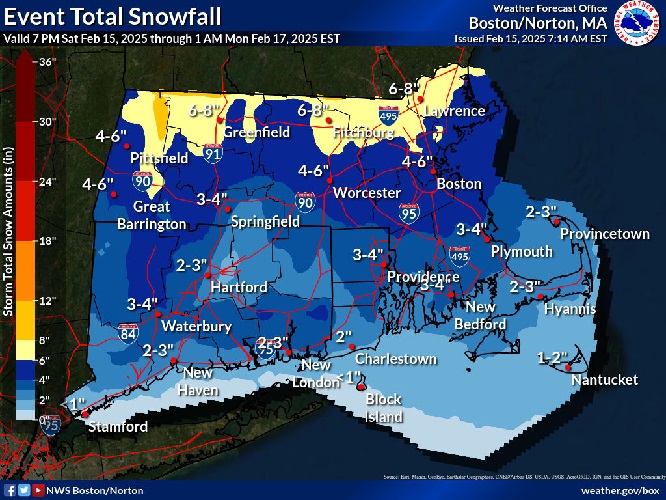
According to the National Weather Service, tonight the snowstorm arrives, changing to an icy mix then all rain for most locations on Sunday (except the highest elevations). Periods of moderate to heavy rain continue all day Sunday.
Next, very gusty winds will kick in behind the storm and continue into the first part of the week. A High Wind Watch has been issued for the potential of gusts as high as 60 mph at times on Monday. This will also come with much colder temperatures Monday into Tuesday.
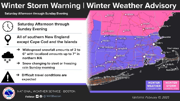
A Winter Weather Advisory has been issued for all of southern New England except the Cape and the Islands from 1 PM this afternoon to 7 PM EST Sunday.

Plan on slippery road conditions.
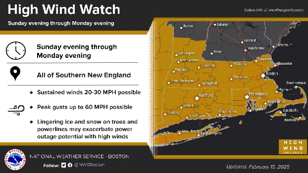
The High Wind Watch has been issued for southern New England from Sunday evening through Monday evening.
Damaging winds could blow down trees and power lines. Power outages are possible. Travel could be difficult, especially for high profile vehicles.


