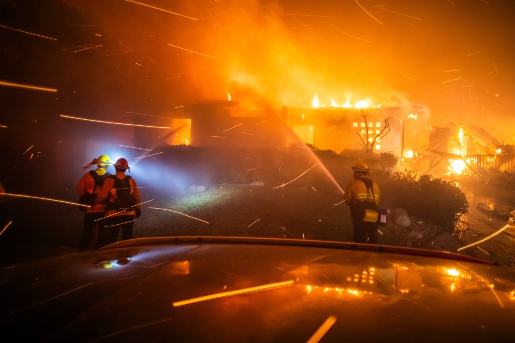
In the hours before fierce Santa Ana winds rushed through the canyons of Los Angeles, igniting homes and claiming lives, we felt Diablo winds here.
But they just created ripples in mud puddles. They stirred the heavy leaves on soggy trees. They warmed our yards and sent fresh breezes through the air, slightly scented with the perfume of early manzanita and daffodil blossoms.
“The same weather system that generates Santa Ana winds also produces Diablo winds, often 12 to 24 hours earlier,” said atmospheric scientist Neil Lareau of the University of Nevada in Reno. In the coming days, we’ll continue to see stronger northeast winds around the Bay Area.

The Diablo and Santa Ana winds, officially classified as a foehn wind condition, are an age-old meteorological phenomenon.
Just as water tends to seek its own level, so air wants to equalize its pressure, flowing from areas of high pressure to areas of low pressure, said Jan Null of Golden Gate Weather Services.
“Everything’s trying to reach equilibrium,” he said.
The winds are conceived in the deserts of the northern Great Basin, where high pressure builds. This strong high-pressure system is more common during the cooler weather season.
Then they race west toward the troughs of low-pressure regions along the California coast. Dubbed “inside sliders,” they drop down the flanks of the Sierra, picking up speed.
Then they funnel through mountain passes, such as Southern California’s Soledad Pass, Cajon Pass and San Gorgonio Pass, where the so-called Venturi effect accelerates their speed. They also contribute to large offshore waves on the coast and potentially dangerous conditions.
Winds on Wednesday night gusted between 50 and 70 miles per hour at lower elevations, peaking at 80 to 100 miles per hour in the Santa Monica Mountains — the equivalent of a robust Category 1 hurricane.
 Recent winds were so strong that they crested and descended the San Gabriel Mountains and didn’t just rush through passes, according to Lareau.
“The winds are at the upper end of the spectrum for Santa Ana winds but not unprecedented or outside of our range of expectations,” Lareau said.
A similar phenomenon is seen in other mountainous areas around the world. In the Rocky Mountains, it’s called a Chinook wind; in the Alps, it is called favogn; in the Andes, it’s called a puelche.
As the air sinks and compresses into a low pressure trough, it heats up.
So while much of the nation is suffering through cold, snow and ice, Friday’s temperatures in San Jose hit a balmy 73 degrees. It was 68 degrees in Oakland. Even San Francisco, at 59 degrees, felt comfortable.
But as the temperature rises, relative humidity drops. Fuels with 20% moisture can catch fire; light fuels with 2% moisture can burn like gasoline.
They contributed to some of the most destructive wildfires in recent years, such as the Tubbs Fire of 2017, which destroyed parts of Santa Rosa, and the Camp Fire of 2018, which destroyed the town of Paradise.

The exact trajectory and strength of the winds can vary. They are influenced by the strength and location of the “Great Basin High,” as well as the strength and location of the lower-pressure system to its southwest.
In the Bay Area, the flow often shifts when they encounter the Coast Range, which can channel the wind over ridges and down canyons.
This pattern is most common in the fall, as the polar jet stream makes its seasonal progression southward.
(In the spring and summer, everything is turned around. Air rushes eastward from the ocean toward inland valleys, creating afternoon breezes and dense fog.)
While the Diablo and Santa Ana winds are most prevalent in the fall, their frequency and intensity persists through the “cold season.” A study by Carrie Bowers of San Jose State University found that the average monthly number of Diablo wind events is higher in January than November and about 80% as common as in the peak month of October.
In the autumn, they keep us on high alert. Nerves are jumpy. A faint whiff of smoke creates unease.
But by January, the threat feels less palpable, because the landscape is usually wet. San Francisco International Airport, for instance, has received 107% of the year’s average annual rainfall.
Southern California has had little rain, leaving most of the region extremely dry.

