NIFC predictions prove accurate as Los Angeles battles multiple blazes
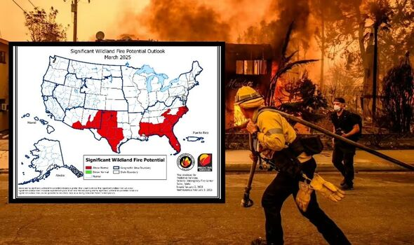
New wildfire prediction maps released by the National Interagency Fire Center (NIFC) paint a concerning picture for several US zones over the next three months, with forecasts already proving accurate as Los Angeles grapples with six devastating fires.
The January forecast correctly predicted heightened fire risks in Southern California, where current wildfires have:
- Destroyed an estimated 10,000 structures
- Burned over 20,000 acres in Los Angeles County
- Achieved zero containment in the Palisades and Altadena fires
- This resulted in five fatalities


Texas and Southeast zones at high risk
Texas emerging as a major concern
“Exceptional drought” conditions plague Texas, with the forecast showing:
- Escalating threat levels beginning in February
- Spread into western Oklahoma and eastern New Mexico
- Particularly vulnerable areas near Austin and San Antonio due to excessive grass growth
Florida’s growing fire potential
The outlook for Florida shows:
- Expanding fire risk zones from central Florida northward
- Dead vegetation from hurricane damage increases danger
- Critically low water levels despite recent rainfall
- Risk extension along Atlantic coast into eastern Virginia
The NIFC maps detail a concerning progression:
- January: Southern California and Central Florida primary risk zones
- February: Texas fire risk intensifies and expands
- March: Threat spreads across Southeast, including Mississippi, Louisiana, and the Carolinas
- April: Continued elevated risks across multiple zones
Some zones spared
The forecast offers some relief for certain areas, with the Pacific Northwest, Northern Rockies, and most of the Great Lakes region showing normal fire potential through April, typically experiencing minimal fire activity during these months.
Fire officials continue to warn about the possibility of additional wind-driven fires throughout the winter season, particularly in regions already experiencing severe drought conditions.

