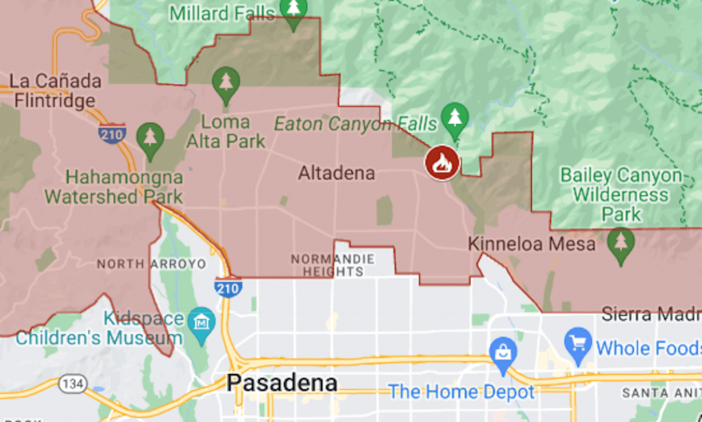
On a second front in Los Angeles County’s wildfire battle, the Eaton Fire forced evacuations of residents near the foothills of the San Gabriel Mountains.
The fire was reported around 6 p.m. Tuesday, Jan. 7, near a trailhead in Altadena, and evacuations began an hour later. On Wednesday morning, the order covered more than 30 square miles from La Cañada Flintridge to Monrovia. The fire’s size was estimated at 2,227 acres (3½ square miles), the California Department of Forestry and Fire Protection said.
The map above shows the evacuation area in red and the approximate perimeter as a black line. For updates and details, including the warning areas, see the Genasys Protect map or the Los Angeles County emergency site.
Eaton is one of three wildfires for which evacuations have been ordered in the Los Angeles area. Palisades is burning in the Pacific Palisades area, and Hurst in Sylmar, at the north end of the San Fernando Valley.

