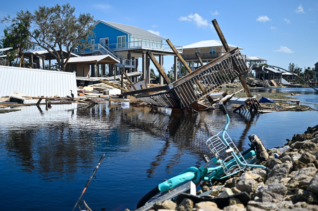
Hurricane Helene’s rampage killed more than 200 people, with the death toll still rising, making it the second-deadliest hurricane to strike the U.S. mainland in the last 50 years.
The National Weather Service and other weather experts have recently released final data on how strong, fast and destructive the storm was.
Here’s a look at some of the harrowing numbers from along Helene’s path of destruction.
Landfall and shocking west coast surge
Helene traveled up through the Gulf of Mexico, growing to an immense width — 690 miles — and traveling at a high speed. Both of those factors would prove deadly.
In Florida’s Big Bend region where the storm made landfall, up through the Tallahassee, there were five direct fatalities and two indirect fatalities.
Devastating storm surge rolled in at ground zero, Apalachee Bay, pushing more than 15 feet of water onto normally dry areas.
The highest rainfall, 14 inches, fell in Sumatra, just north of Apalachicola Bay, which was actually on the weaker left-hand side of the storm.
The storm was moving so fast that it produced a wide swath of wind damage piercing far inland, toppling grand old trees and causing widespread power outages.
The Suwannee Valley, north of Gainesville, Florida, saw winds of 75 mph to 100 mph, and the maximum wind gust of 100 mph was measured farther north, at Alma, Georgia, a whopping 134 miles inland from landfall.
The big story for the area south of landfall was the outlandish amount of storm surge, even in areas such as Tampa, some 180 miles away.
Cedar Key, 90 miles from landfall, saw a storm surge 10 feet over the expected high tide. Wind was also a factor, with sustained winds of 56 mph and gusts up to 73 mph.
The Tampa area saw record-breaking surges, even though they were not in the hurricane’s path.
The East Bay section of Tampa saw 7.2 feet of surge, and Old Port Tampa, Clearwater Beach and St. Petersburg all saw close to 7 feet.
Even in Fort Myers, some 280 miles from landfall, there was more than 5 feet of storm surge.
Weather experts said that the surge was driven by the massive width of the storm, and the fact that its path was far out to sea in the Gulf.
That gave its winds more time to push more water. Another factor making the surge worse was the gradual slope of Florida’s Gulf coast.
South Florida got off easy. The highest sustained winds were 38 mph at Turkey Point near Homestead, and the highest gusts were 63 mph at Miami Opa Locka Airport.
Fort Lauderdale-Hollywood International Airport had gusts of 56 mph.
The highest storm surge in southern Florida unsurprisingly occurred on the west coast, in Naples, at 4.02 feet.
By comparison, South Port Everglades’ tide gauge showed waters 1.11 feet above normal tide levels.
Destruction in the mountains
Helene unleashed massive flooding on southern Appalachia. The highest measured total was 30 inches in Busick, North Carolina, atop the Blue Ridge Parkway northeast of Asheville.
For context, Fort Lauderdale was pummeled by 24 inches of rain in April of 2023, leaving cars stranded and people wading up to their waists. But that was on flat ground.
Busick’s elevation is 2,930. Nearby Mount Mitchell is a steep 6,684 feet. Asheville is downstream at 2,134 feet. All that water had to compress into valleys and hollows. From there it shot downhill, wiping roadside hamlets away, and flooding Asheville’s arts district.

NOAA’s National Water Center posted on X that estimated rainfall amounts across the southern Appalachians made Hurricane Helene a 1,000-year storm, meaning “there is less than a 0.1% chance (annual exceedance probability) of that happening in any given year.”
Meteorologist Ben Noll, who specializes in climate science mapping, wrote on X that Helene’s moisture plume “was the most intense on record for parts of six states: Florida, Georgia, South Carolina, North Carolina, Tennessee, and Virginia.”
He measured what’s called the integrated vapor transport (IVT) of the storm. IVT is the amount of pounds or kilograms of water vapor that move across a given square meter in one second.
“The integrated vapor transport (IVT) associated with Helene was up to around 1.5 times higher than any previous system in this region since at least 1940,” he wrote.
According to AccuWeather, Helene dumped a shocking 42 trillion gallons of rainfall on the Southeast.
That’s enough water to fill Lake Tahoe once, the Dallas Cowboys’ stadium 51,000 times, and enough water to flow over Niagara Falls for almost two years.

Preliminary estimates from Moody’s Analytics indicate that Helene did $34 billion worth of damage to the southeastern United States. Other estimates are much higher.
It’s unclear how climate change is affecting the frequency of such storms, but warmer water and warmer air have prompted experts to believe that climate change is causing storms to grow more intense more quickly, and carry more moisture.
Originally Published:


