LINCOLN, Neb. (KOLN) – There has not been any measurable snowfall so far this season in Lincoln, but that is expected to end in a remarkable way as the first accumulation is brought on by a powerful winter storm.
Snow could start falling Saturday morning across central Nebraska along with freezing precipitation along the Nebraska/Kansas border. However, the majority of the snow arrives later in the day and continues overnight and into the day on Sunday.
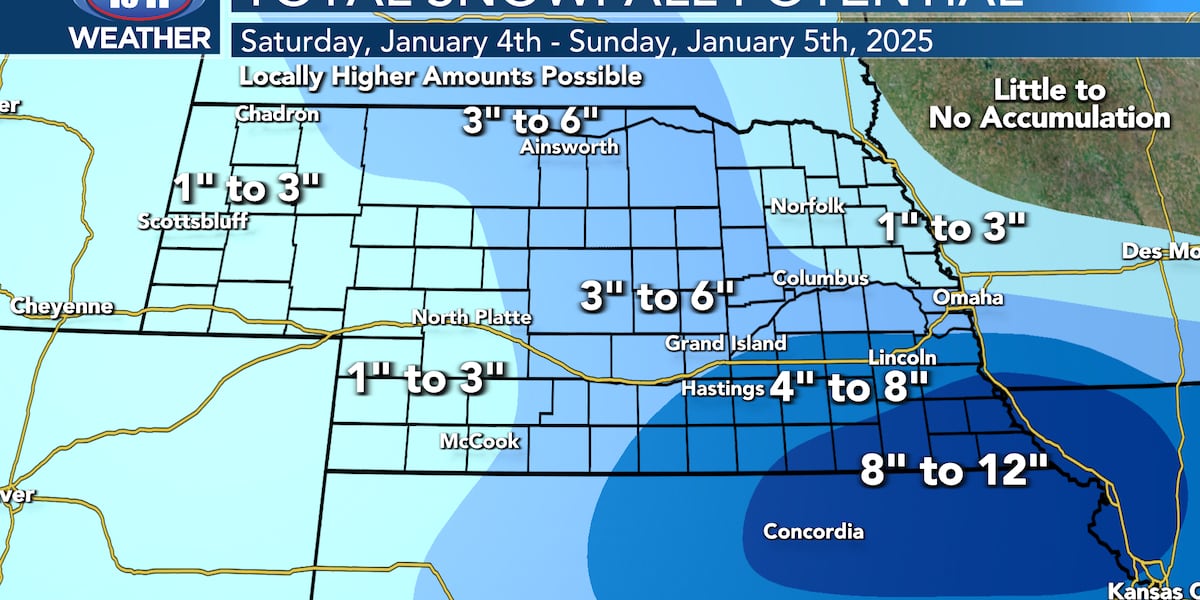
When it’s all said and done, 4-8″ could fall in Lincoln with 8-12+″ in southeastern Nebraska. Lesser amounts are expected further to the north and east. There will likely be a fairly sharp cutoff with snowfall totals from north to south so make sure to stay tuned to the forecast for any and all updates.

As of right now south-central and southeastern Nebraska are under winter storm watches (with winter storm warnings likely going to be issued later on Friday). Highest confidence in heavy snowfall remains in far southeastern Nebraska but along and south of I-80 will see moderate to major travel impacts as well.

Frigidly cold air then arrives heading into next week with subzero lows and wind chills very likely.

Click here to subscribe to our 10/11 NOW daily digest and breaking news alerts delivered straight to your email inbox.
Copyright 2025 KOLN. All rights reserved.

